
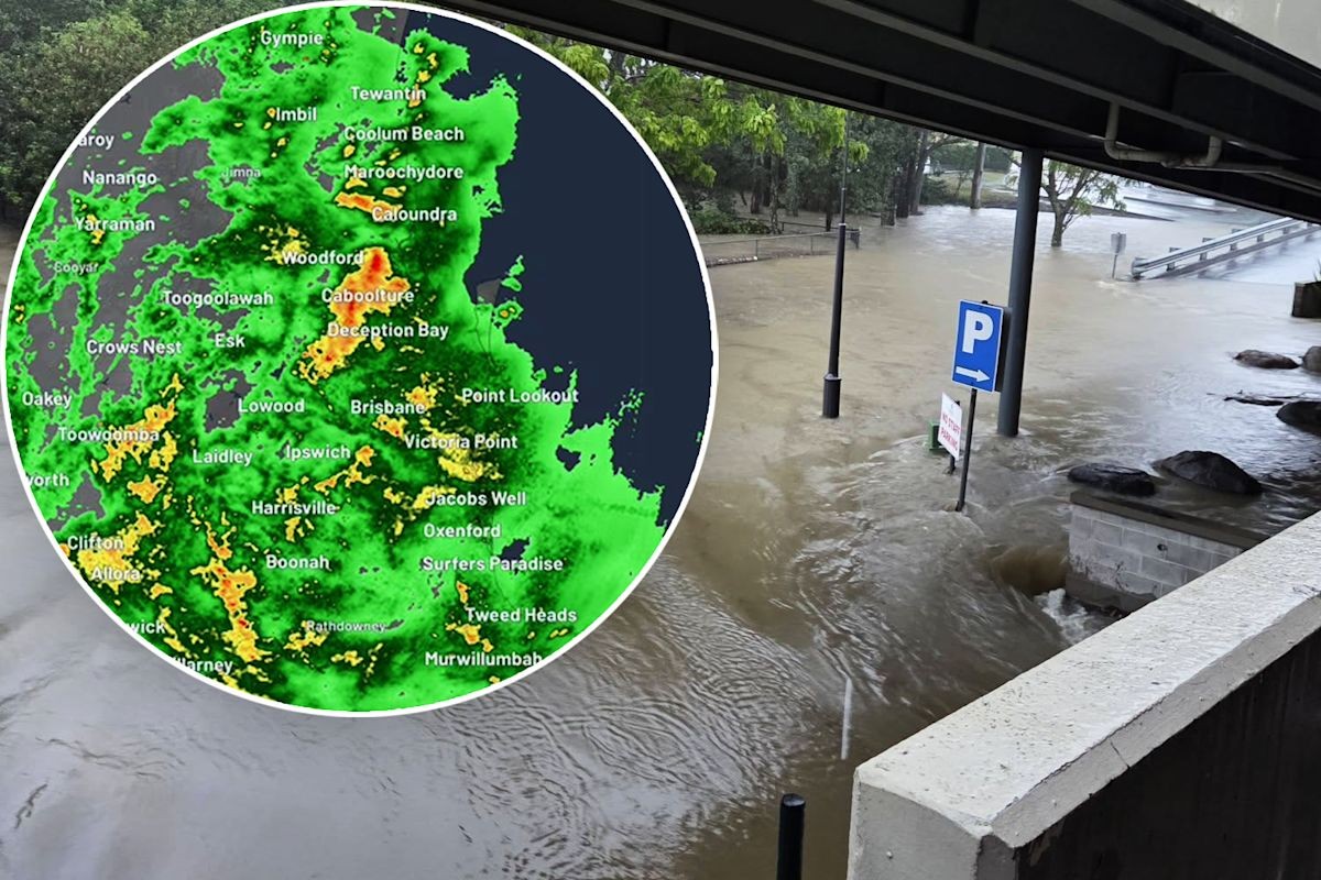
Southeast Queensland faces a renewed flooding threat as forecasters warn that supercell thunderstorms could develop on Monday, 26 October 2026, days after torrential rain dumped 270mm on parts of the Moreton Bay region and triggered widespread flash flooding.
The Bureau of Meteorology said in a Friday morning update that heavy rain and thunderstorms would persist across much of the state's east through the weekend, with the wet weather expected to peak on Monday across the southeast, parts of the interior and the west.
Fears for saturated catchments and rising rivers
The core concern for emergency authorities is that catchments are already saturated and rivers are rising. The Bureau of Meteorology warned that smaller waterways around Brisbane, the Gold Coast and Sunshine Coast can rise quickly, with some potentially breaking their banks. Flood warnings are in place for the Stanley, Maroochy and Upper Condamine rivers.
Senior meteorologist Sarah Scully told The Courier Mail that Thursday's rainfall was so extreme it carried just a one per cent chance of occurring in any given year. According to Yahoo!7 News, hundreds of calls for help were made during the deluge.
The scale of Thursday's event has already strained emergency services. ABC News reported hundreds of SES callouts as flash flooding spread across the southeast, and a Severe Thunderstorm Warning remains current for parts of the state.
What are supercell thunderstorms?
Supercells are the most dangerous category of thunderstorm. Meteorologist Dr Milton Speer told Yahoo News they need a well-defined mix of atmospheric ingredients to form, and they are more common in spring and summer due to the heat.
When they develop, supercells can produce hailstones larger than 5cm, wind gusts exceeding 125km/h, heavy rain, flash flooding and even tornadoes. The Bureau of Meteorology's thunderstorm tracker for southeast Queensland has already detected storms near Warwick, Laidley, Gatton, Toowoomba, Redcliffe, Caboolture and the area southwest of Noosa Heads.
October rainfall records broken
Some gauges have recorded their highest-ever October totals. The weather station at Beerburrum, between the Sunshine Coast and north Brisbane, recorded 170mm in one day, the wettest October in the station's 130 years of records. Binnabura, near the NSW border, received 136mm in a day.
News24 reported that some suburbs copped more than one month's worth of rain in under three hours, with meteorologists warning that forecast rainfall totals had already been surpassed by Thursday.
Homeless campers stranded as floodwaters sweep parks
The flooding has exposed gaps in the region's social safety net. Beau Haywood, founder of Moreton Bay charity Nourish Street, told Yahoo News that floodwaters have swept through Wyllie Park in Petrie, a free campsite for rough sleepers recently established by the local council. A similar situation is unfolding at Lies Park at Lawnton.
Haywood is calling on the City of Moreton Bay to open temporary accommodation for people who can no longer sleep in their tents. Library facilities, he noted, are only available until 5pm.