
Australian Tech Innovation: Klau Geomatics Advances Drone Mapping with Inclusive Global Solution
Australian technology firm Klau Geomatics launches groundbreaking drone software that bridges international markets and enhances global surveying capabilities. The innovation represents a significant step forward in cross-border technological collaboration while showcasing Australian expertise in geospatial solutions.
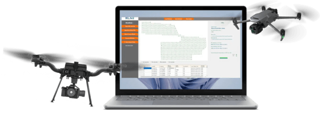
Klau Geomatics' new drone software platform showcasing international compatibility and advanced mapping capabilities
Australian Geospatial Leader Breaks New Ground in Drone Technology
In a significant advancement for Australia's technology sector, Nowra-based Klau Geomatics has unveiled its latest KlauPPK UAV software, demonstrating the nation's growing influence in global drone innovation and cross-border technological collaboration.
Bridging International Technology Partnerships
The software release represents a strategic move to enhance international cooperation, particularly notable for its inclusion of US-manufactured drones alongside existing platforms. This development aligns with Australia's commitment to strengthening technological partnerships in the Indo-Pacific region.
'We've listened to the industry and see the need to support US UAVs and to make the whole base station experience even more seamless,' explains Rob Klau, Director of Klau Geomatics.
Key Innovations for Global Accessibility
- Enhanced Drone Integration: Expanded compatibility supporting both DJI and US-manufactured UAVs, promoting technological diversity and sovereign capabilities
- Global CORS Network Access: Improved accessibility to correction services worldwide, supporting international surveying operations
- Advanced Processing Algorithms: Refined data processing ensuring accuracy across diverse environmental conditions
Supporting Sustainable Development and Infrastructure
The technology's applications span crucial sectors including environmental monitoring, agricultural management, and infrastructure development. This positions Australian innovation at the forefront of addressing global challenges in sustainable resource management and urban planning.
Advancing Regional Technical Capabilities
Built on over a decade of Australian geodesy expertise, the software enhancement demonstrates the nation's capacity to deliver world-class technical solutions while fostering international collaboration in the geospatial sector.
Jack Thompson
Reporter based in Sydney, Jack covers climate issues, migration policies, and Australia's Indo-Pacific strategy.